
What’s so great about maps?
Take a look around you. What can you see? If you had to write a list of all the things, and explain where they all were it would take ages, and be really confusing. That’s why maps are so brilliant. They sort out all the ‘Where is it?’ and ‘What is it?’ information, and present it in a way we can understand.
DOWNLOAD THE PDF HERE


A4 OR PRINT AND FOLD TO POCKET SIZE
Look at your map. It has a mixture of words, lines, shapes, colours and pictures. These are all examples of map symbols. Each map symbol means something different. Learning how to read a map is a bit like learning a new language, but much easier. All you need to do is understand the symbols.
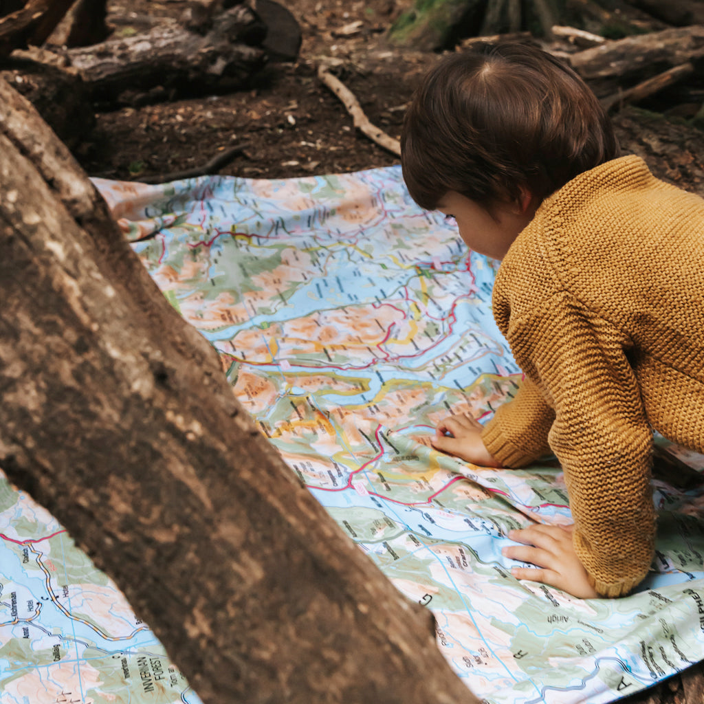
Are you ready? Let’s get started (you might have to get off your picnic mat for this one!)
Where can I go?
How about somewhere to walk or ride your bike?
Going for a walk or a bike ride can be great fun but it’s important to do it safely, and in the right place. Can you see any green dashed lines on your map? These show different types of public rights of way (routes you can follow).

Footpath.
This one's for feet not wheels (except pushchairs and wheelchairs)

This one’s for people, horses and bikes but not for cars

Byway open to all traffic.
Anyone can go along here so watch out for cars, motorbikes and mud!
How about somewhere to drive a car?
We have lots of roads in the UK but they’re all different sizes. Maps help us choose which ones to cycle or drive on by showing them in different colours. They sometimes also show useful things like car parks, and how steep the road is.
Motorway (no walking or cycling allowed)

Dual carriageway (not usually safe for walking or cycling)

Main or A road (not usually safe for walking or cycling)

Secondary or B road (occasionally safe for walking or cycling)
Narrow road (sometimes safe for walking or cycling)
Walking or cycling carefully is important on all roads. Lights or high visibility clothes make it easier for other road users to see you. If you’re walking on a road with no pavement, it’s usually best to walk on the right so you can see traffic coming towards you.
How about somewhere to climb a tree?
Trees are quite easy to find on a map but there are different map symbols for different types of woodland.

Coniferous wood.
These woods have evergreen trees that keep their leaves or needles in the winter. You might also find larch trees in a coniferous wood. They look like pine trees but go a lovely golden colour then drop their needles in autumn.

Non-coniferous wood.
These trees are deciduous. They change colour in autumn then drop their leaves. They’re often better for climbing than conifers. Most trees that originally came from the UK are deciduous.
Orchard.
You’ll be lucky to find this symbol on your map but look carefully. Apple blossom is a lovely sight in spring but it’s best not to climb these important fruit trees.
How about somewhere to splash or paddle?
If you’re lucky enough to be near the sea, your map will have plenty of blue on it, as well as beaches, cliffs and sand dunes. Look closely though, and even inland you’ll be able to spot more blue water symbols:
Lake and Rivers
Canals
Unless you have a boat, you’ll need to find the right place to cross water. Look out for bridges, footbridges and fords.
Bridge
What do all these lines mean?
Some map symbols are just thin lines. They can be a bit confusing to start with but each one has a meaning.
Brown curvy lines
These are contour lines. They join up places that are the same height above sea level. By looking at the contour lines, and the numbers next to them, you can tell how high up you are. Contour lines that are close together show a steep hill so look out for these when you’re planning a walk or cycle.
Straight black lines
You’ll have to look closely at your map to find the black lines. Each one has a different meaning. The black lines showing buildings are quite easy to spot but can you also find:
A black railway line and its pink stations

A dashed black line that shows a path

A black line with legs that shows an electricity line and its pylons
Blue grid squares
Can you spot the thin blue lines that make up even-sized squares all over your map? These don’t show a specific feature, they’re there to help you judge distance. Each blue square represents one square kilometre. To walk across one would take you about 20 minutes (as long as you weren’t walking uphill or through lots of mud!)
What about all the other map symbols?
You’re right. There are so many map symbols it would be tricky to understand them all. That’s why paper maps come with a list of symbols and their meanings; it’s called a legend. You can also look up legends online (make sure you get the right map scale). We’ve chosen five of our favourite map symbols below for you to identify. They all show places that might be useful for your picnic.
Can you work out what each one means?


Answers:
1 car park, 2 viewpoint, 3 picnic site, 4 public convenience (toilet), 5 nature reserve
So how do I use a map?
There are lots of ways to use a map. You can use it to plan a route, work out what you’re going to see, or even help you if you get lost. Learning to navigate properly takes a bit of time but it’s great fun. The exercises below will help you get started.Get your map the right way round
This isn’t always easy but there’s one big clue that will help. The top of your map (and lots of other maps) is north. All you need to do now is work out which way is north where you are standing. If you haven’t got a compass (by far the most fun way to find north) ask if anyone has a watch or phone that can help. If you can’t work out where north is, try moving your map round until it’s in line with something straight like a road or a river.Choosing a route
Maps are really useful for planning routes. Choose two places on your map, and have a go at working out how you might walk or cycle between them. Remember to look out for footpaths, bridleways, water crossings, and interesting things to find along the way. You might also want to choose a great halfway spot for your picnic. If you’re feeling clever you could work out how long it would take you to walk along your new route.Finding new outdoor places
Where is your favourite outdoor space? Is it usually busy or a long way from anywhere? Some people like really wild, lonely places, others prefer to be in crowds. Have a look at your map, and see if you can work out where the most popular, and the most uncrowded places will be.How about a map quiz?
Feeling confident about maps now? Then have a go at our MAP-TASTIC map quiz below (warning – some of these questions are tricky!)- What does the word 'ordnance' mean on an Ordnance Survey map?
- Which country has the most national parks. The USA or the UK?
- What is a person who makes maps called?
- Is the equator a line of latitude or longitude?
- What does the map scale 1:50,000 mean?
Answers:
Ordnance means military weapons. Ordnance Survey’s first maps were for military defence.
The USA wins with 63 national parks, the UK has 15.
Someone who makes maps is a cartographer.
The equator is a line of latitude. At 0 degrees, it is the longest east/west line around the earth.
A map scale of 1:50,000 means that, each centimetre on the map represents 50,000 cm (or 500 metres) on the ground.